"The City of Subdued Excitement"
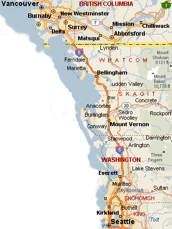
Located just 20 miles south of the Canadian border and 90 miles north of Seattle, Bellingham's nickname describes it's understated charm very well. In the nineteenth century it was a coal mining and lumber port. In the twentieth century it became a paper mill and salmon canning town. Now only the salmon fishing business remains, albeit on a vastly reduced scale. The 137 acre site of the former paper mill on the waterfront is being redeveloped for retail, residences, offices and open parks.
Today Bellingham, with a population of 82,000, has a more divirsified economic base with three main pillars; Western Washington University with it's 14,600 students, it's the county seat for Whatcom County, and it's a regional center for health care services. Plus it supports the agricultural interests (raspberry and blueberry growing) in the county.Tourism from Canada and Seattle contribute substantial income too.
In late October Anne and I, and our two dogs, drove up to Bellingham and spent five days there exploring the area and housing opportunities. Then we drove home down the Olympic Peninsula. Shown below are some SNAPSHOTS from the trip.
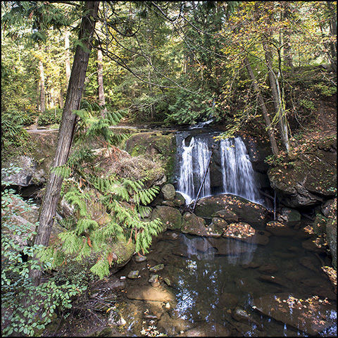
Whatcom Falls
While we were looking at real estate in the area, we decided to drop into the 210 acre Whatcom Creek Park. It is heavily forested with giant Douglas fir trees and western red-cedars. Whatcom Creek flows year round, and there is even a trout hatchery that feeds fish down into the Bay. In October water flow levels are at their seasonal lows.
Bellinham has over 20 parks with more than 50 miles of trails for walking, running and biking. Sixteen percent of the city's total land area is park, trail or natural preserve. And just outside the city Larabee State Park and the Chuckanut Mountain Parklands provide another 5,000 acres of wilderness and more than 40 miles of trails.
And finally there is Lake Whatcom. It's located in a pretty valley just east of town. It's 13 miles long overall and as much as a mile wide with a depth of between 60 to 328 feet. It's fed by 34 creeks and streams and is the principal water source for the city. But it also offers lake front living and water recreation opportunities for the local residents. Just one more remarkable asset in this surprising town. It drains down Whatcom Creek (shown at the left) and eventually into Bellingham Bay.
Taylor Avenue Dock
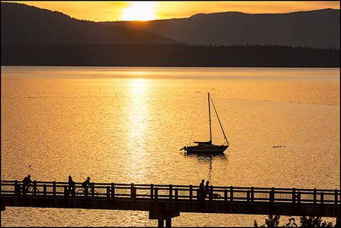
One night we decided to have dinner at Keenan's Restaurant in the Chrysalis Inn, a luxury boutique hotel in Fairhaven. It is one of the favorite places in the area to watch the sun setting over the Bay and Lummi Island.
It also overlooks the Taylor Avenue Dock. This is a one-third mile long promenade built out over the water where there used to be a salmon cannery. Harbor seals and sea stars can be viewed from the walkway. It's part of the South Bay Trail that connects downtown Bellingham to Fairhaven.
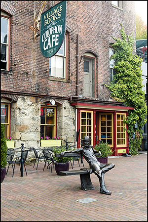
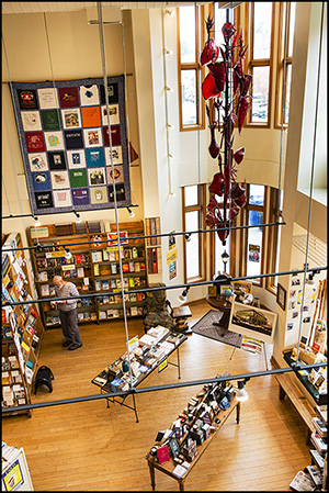
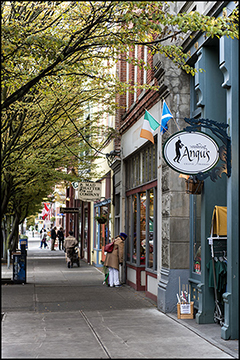
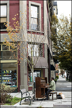
Fairhaven Neighborhood Scenes
Chuckanut Drive
Chuckanut Drive has been called a mini-version of Highway 1 in California. Beginning in Fairhaven, it winds 15 miles down the coast of Chuckanut Mountain offering stunning views of the San Juan Islands and Northern Puget Sound. It's also home to the well-known Taylor's Oyster Farm.
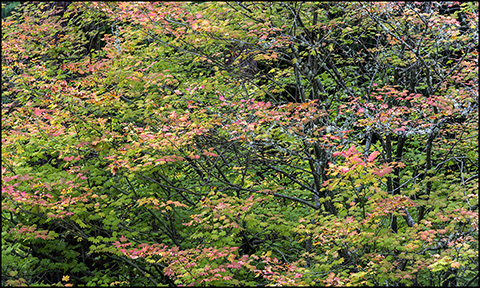
We stayed in a VRBO cabin (the Pond Cottage) just off Chuckanut Drive while we were in Bellingham. It was a great place for our two dogs. The maple trees were just beginning to turn red in the woods around it.
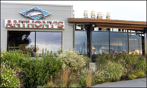
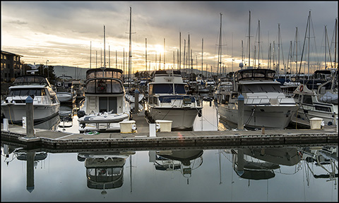
Anthony's at Squalicum Harbor
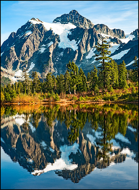
Mt. Baker & Mt. Shukasan
One day we drove up to the Mt. Baker Ski Area, which is only 65 miles from Bellingham. The ski area base is at 4,300 feet which would be low by California or Colorado standards. But Mt. Baker rises to 10,778 feet from there and receives over 650 inches of snow annually. To the north of Mt. Baker, stands the shorter (9,131) Mt. Shukasan shown in the photo on the left. Both mountains have glacier snow on them year-round, particularly on their north sides.
Again while many of the mountains in California and Colorado are over 14,000 feet high their bases are usually 7-8 thousand feet above sea level to begin with; whereas Washington's peaks rise up from a much lower elevation. And their highest peak, Mt. Ranier, at 14,411 feet is just slightly below Mt. Whitney, the highest in the Continental U.S.
The photograph on the left was taken from the edge of Picture Lake, a gathering place for photographers year round. In the summer and early fall the colors in the foilage around this lake can be spectacular.
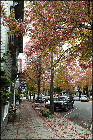
Port Townsend
On our way home we took a Washington State Ferry over to Port Townsend (below) on the north end of the Olympic Peninsula. On the left are two views of Main Street in this 1880's town.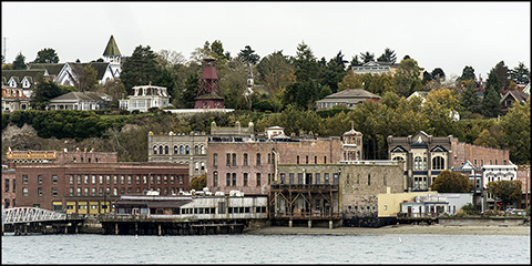
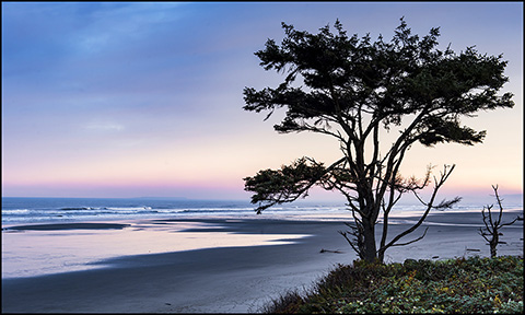
Olympic National Park
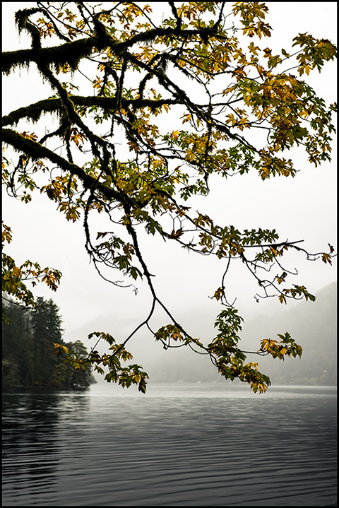
It was rainy and foggy as we drove across the Olympic Peninsula, so we couldn't explore either Hurricane Ridge or the Hoh Rain Forest. The photograph on the left, taken along the shore of Lake Crescent captures the feeling of the day. But the next morning the sun peeked out and lit up the ocean beach outside the Kalaloch Lodge where we stayed overnight. From there we drove down Highway 101 to the Columbia River and into Oregon, and back home via I-5.
Overall it was a great trip. Anne and I look forward to our ultimate return to Bellingham some time soon to explore the area more, reconnect with the new friends we made during our brief visit and become active members of the Bellingham community.